- Version
- Download 5546
- File Size 0.00 KB
- File Count 1
- Create Date 1 December 2011
- Last Updated 27 September 2023
Under The Glacier 2011 Archaeological investigations on the fishing station at Gufuskálar, Snæfellsnes
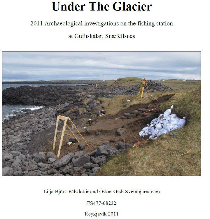
The site of the fishing station Gufuskálar is located on the northern side of the western tip of Snæfellsnes peninsula in the West of Iceland. It sits at the shore of the Atlantic ocean which causes a major threat to the site. A dominant feature in the landscape is the cone-shaped 1446m high glacier Snæfellsjökull, known by many from Jules Vernes book “A Voyage to the Centre of the Earth“. Underneath the glacier is a volcano which has shaped the surrounding area with several lavaflows, the last one 1750 years ago.
Archaeology is abundant at Gufuskálar with two main mounds made up of structures and midden material right by the seafront along with a cleared landing spot. A little further inland are two farm mounds and at least 47 other structures which most likely are fishing booths, þurrabúðs2 and other structures related to the fishing station. In a lava field East of Gufuskálar are 154 small, oval shaped structures made of lava stone. They are commonly believed to be for drying and storing fish.
Samples taken during the 2008 assessment were used for C14 dating and the results indicate the fishing stations time span might be longer than previously thought.
Following assessment in 2008, when four erosion scars were cleaned back and sections drawn, an archaeological excavation took place in 2011. The focus within the site was on the two main mounds by the sea which are under threat by active marine and wind erosion. Based on work done in 20083, four trenches (Tr. Nr. 5,6,7 and 8) were placed in the most eroded areas of the two mounds. A new topographic survey was done on the two mounds but also on other visible structures such as the farm mounds and alleged þurrabúðs. In total, an area of about 7.2 hectares was covered and around 47 structures mapped in.

Share this: